Safest Way API
Use Safest Way's safety data and routing intelligence to build safer journeys, understand night-time environments, and create better experiences for pedestrians.
A Different Way to Think About Navigation
Most routing engines optimise for speed. Safest Way helps optimise for safety.
Our APIs combine crime data, street lighting, monitored streets, environmental context, and local safety signals to provide safer route recommendations and area-level safety insights.
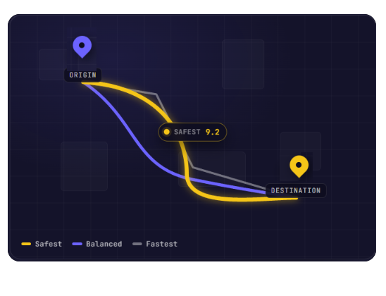
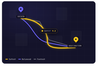
Routing API
Pass us a start and end point. We return multiple ranked routes, each with a breakdown of safety signals, not just the fastest path.
3+ route options per query, ranked by safety score
Per-route breakdown: lighting, crime density, amenity coverage
Flexible weighting — tune what matters most
GeoJSON response, easy to render in any mapping SDK
Origin → Destination, safely scored
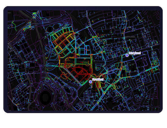
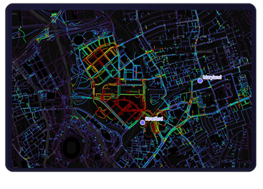
MAP API
Safety Intelligence for Any Location
Lighting map: streetlight density and coverage gaps
Crime heatmap: incident density, incident-type
Composite safety score: single index for any area
Adjustable radius: neighbourhood to city scale
Give us a coordinate or area. We return map layers: lighting coverage, crime heatmaps, and a composite nighttime safety index, ready to render.
Technical overview
Built for clean integration
Formats
GeoJSON
JSON
REST API
WGS84 (EPSG:4326)
+ others on request
CRS
AUTH
API KEY
UPDATES
Monthly
More often
upon request
COVERAGE
London
Greater Manchester
Birmingham
York
Northern Ireland
South Hampton
Continuously expanding to new UK cities
Interested in API Access?
Whether you're building a mobility platform, city dashboard, university service, or safety application, we'd love to hear about your use case.
The map to keep you safe.
Privacy policy
Terms & Conditions
Say hello@safestway.co.uk
And connect with us on social media!
Subscribe to our newsletter!
Copyright (C) 2026 Safest Way. All rights reserved.